Seven days of my journey have now passed. From the fourth to the seventh day, I hiked along the outside of the northernmost point of Switzerland, down to the Rhine. After that, I walked along the river for about 60 kilometers in the direction of Basel. A small hill in the Black Forest brought me to the border with France. The last few kilometers were mostly on asphalt.
Day 4: From the northernmost point to exile in Switzerland
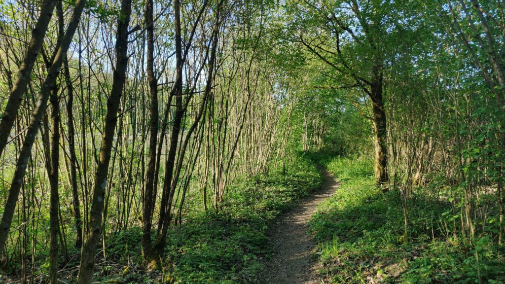
I set off early in the morning. Many flowering trees greet me again. The path leads through a lot of forest. I have to find my way through it at times. Some of the paths haven’t been used in a while. But most of them are gentle forest paths. The birds are chirping, and it’s almost magically beautiful here.
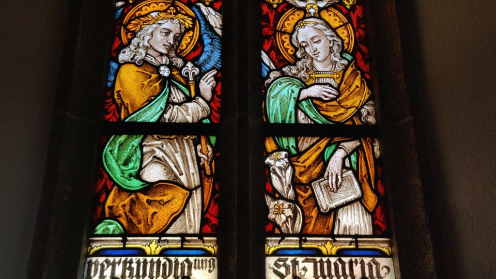
In the small village of Blumenfeld, I come across the St. Michel church. From the outside, it appears somewhat imposing, almost boring. Inside, however, it boasts lavish furnishings. This contrast between the exterior and interior is due to the fact that a church already stood on this site in the 11th century. However, it was demolished in the early 20th century and rebuilt in a historicizing style.
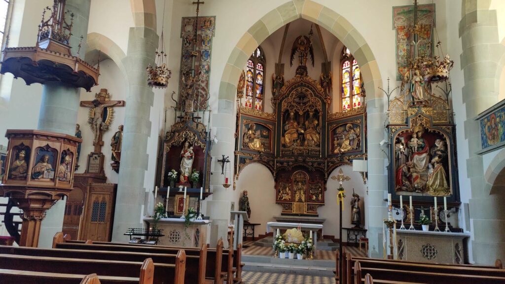
In short, the beautiful interior does not originate from the Baroque period, but it is nonetheless impressive, which cannot necessarily be said of the exterior. The interplay of light from the windows, with its exquisite stained glass art, creates a perfect play of light with the sun’s rays.
My journey takes me through the town of Tengen. The historic town center is well-preserved, but it is somewhat marred by the cars parked everywhere.
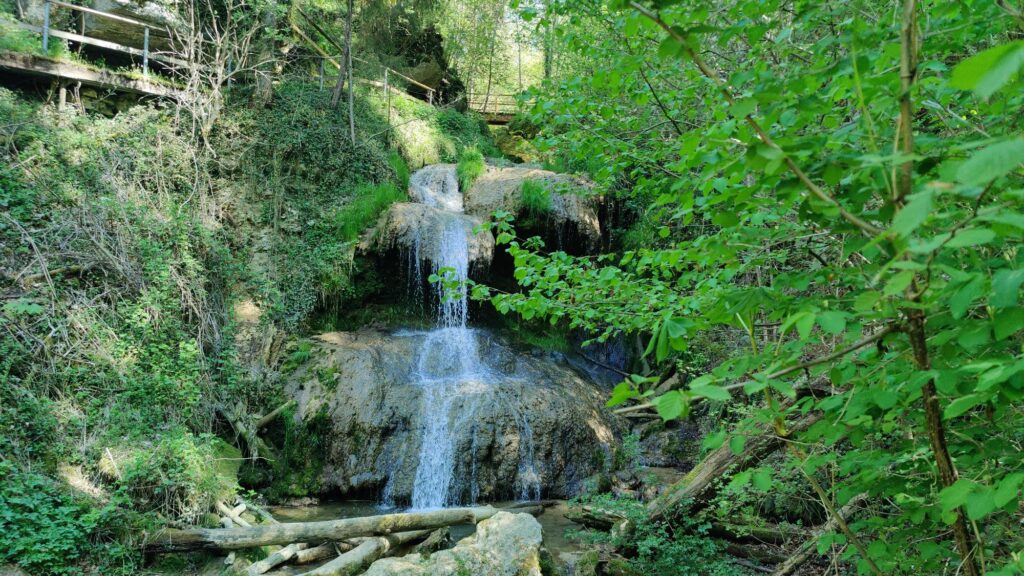
The path leads down into the Mühlbach Gorge. The waterfall there has a drop of 13 meters. I enjoy the natural spectacle all by myself.
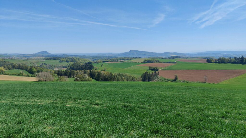
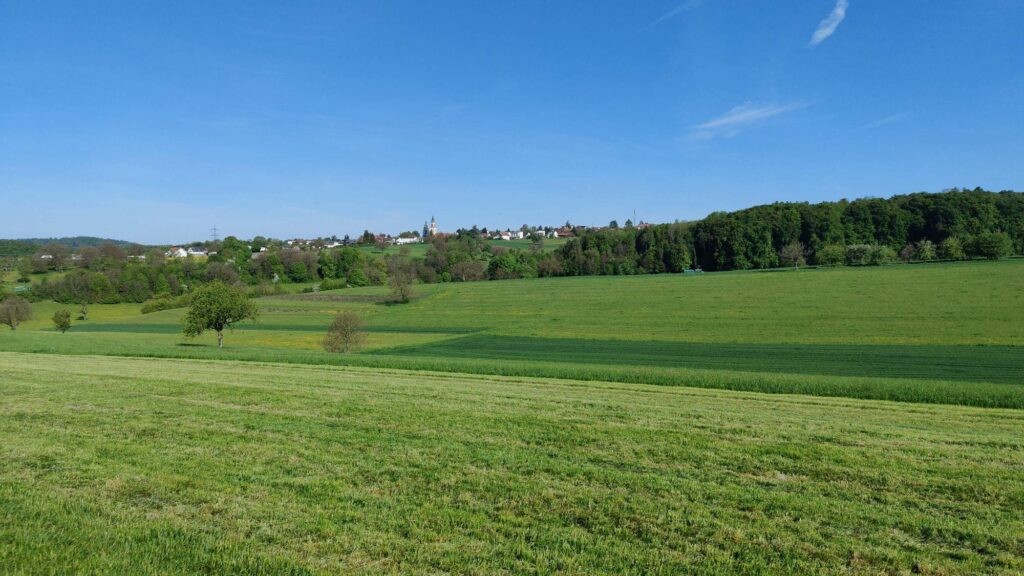
It’s a constant up and down today. On the horizon, I can see the (still) snow-covered Alps. My path leads directly along the Swiss border for a while. On the German side, there’s asphalt. Just across the border, there’s a discreet dirt road.
The state border runs arbitrarily. Sometimes it curves to the left, sometimes it jags to the right. It must be noted that while the border may separate on paper, in reality, nature surpasses the man-made dividing line in every way.
Those who absolutely want to have a border should look for boundary stones; everyone else can simply enjoy the landscape. Although “enjoy” is a relative term. The journey is long until the northernmost point of Switzerland is reached.
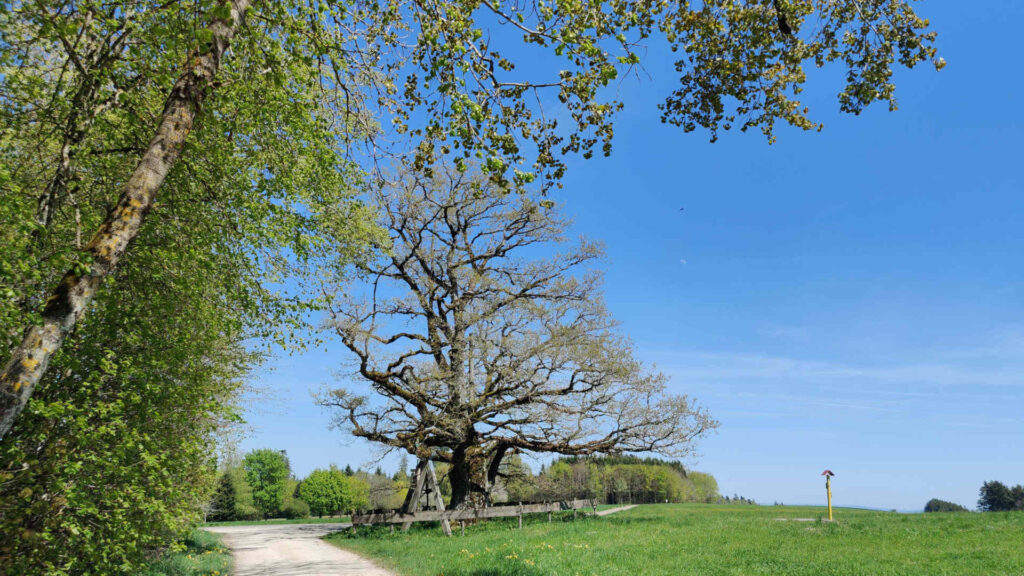
On my journey, I come across the Buchener Stumpen, an oak tree that is over 500 years old. This was long before the present-day border between the Canton of Schaffhausen and Germany was established. The Buchener Stumpen probably doesn’t care about this either; a tree knows no borders, and the Buchener Stumpen certainly doesn’t.
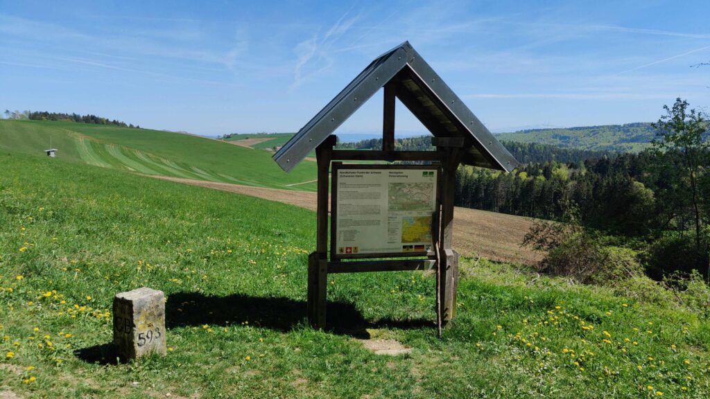
The northernmost point of Switzerland offers a modest spectacle. A border stone and a sign, that’s all there is. In general, it can be noted that the border remains a mystery. It probably originated because certain lands were somehow bought and sold.
Now the path slopes noticeably downwards. From over 800 meters, it descends several hundred meters to Grimmelshofen. In between lies Fützen, a small village. I couldn’t find a shop, but there was lemonade available in an old tavern, before I managed the last few kilometers with tired legs.
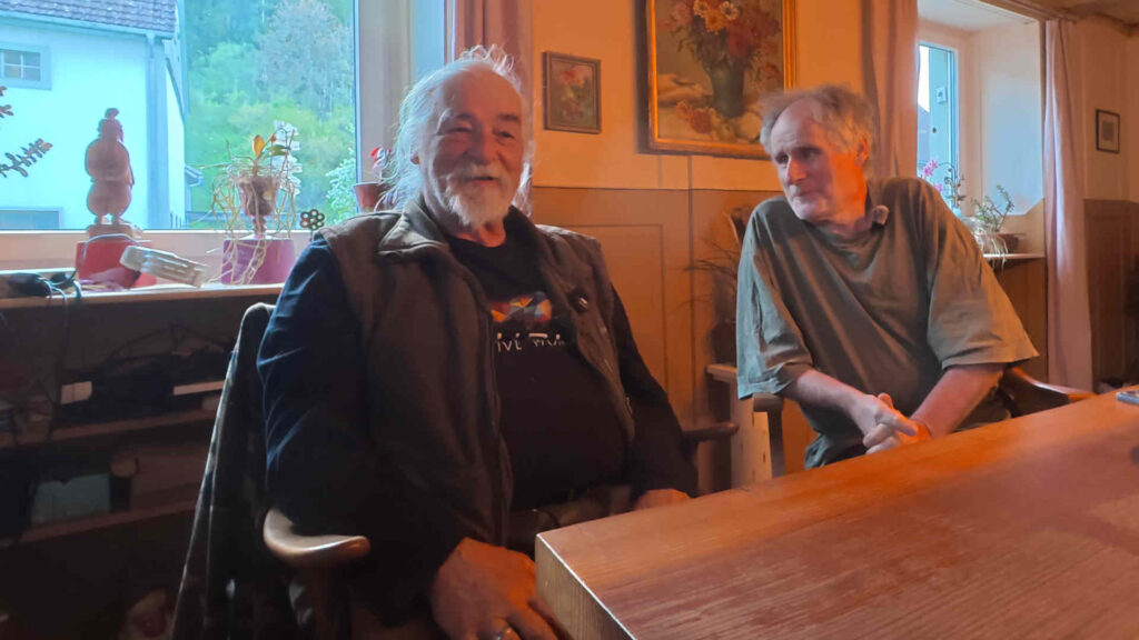
In Grimmelshofen, I meet Urs, who, as a Swiss citizen, lived in the canton of Zug for a long time. Together with Eri, Urs acquired an old farmhouse 14 years ago. After using it as a holiday home for many years, they moved to the Wutach Valley. The border is just a stone’s throw away. They both appreciate that there is simply more space here. The house is huge, there is plenty of room for a workshop, the camper van is parked in the old barn, the garden is immense, and a new bread oven is also on the property.
We spend the whole evening discussing the peculiarities of life in Germany near the border. There are also some curious things: for example, mowing the lawn on Sundays carries a fine of 50 to 50,000 euros. On the other hand, the building regulations (e.g., for a small outdoor oven) are significantly simpler than in Switzerland.
Day 5: To Waldshut and into the Middle Ages
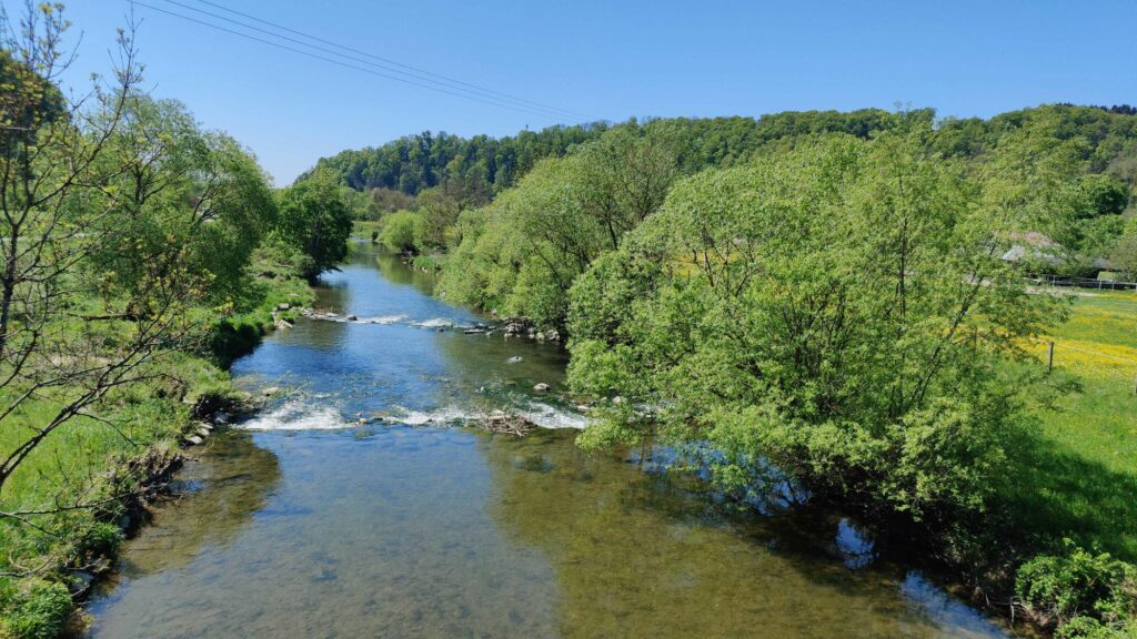
Since Eri and Urs kindly offered me accommodation, and I am very grateful to them, I can set off early the next morning for a hike. At first, it’s cold and shady, but later, warming rays of sunshine accompany me as I hike along the Wutach river, first to the left, then to the right, and finally again to the left, down towards the Rhine.
Originally, the border ran more or less across the countryside, on either side of the river. Border adjustments in the 19th and 20th centuries are responsible for the fact that the Wutach now forms the border for long stretches. And that’s why I’m hiking mostly on the right side of the river.
To reach the Rhine just before Waldshut, I take the shortcut through the forest near Horheim. It involves a few extra meters of elevation, but it saves a few kilometers.
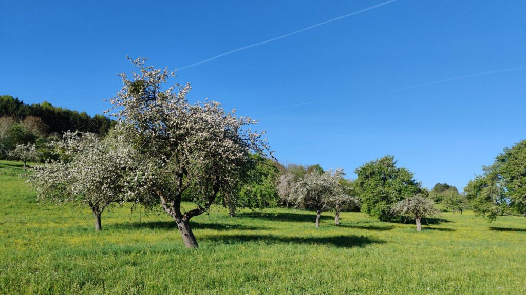
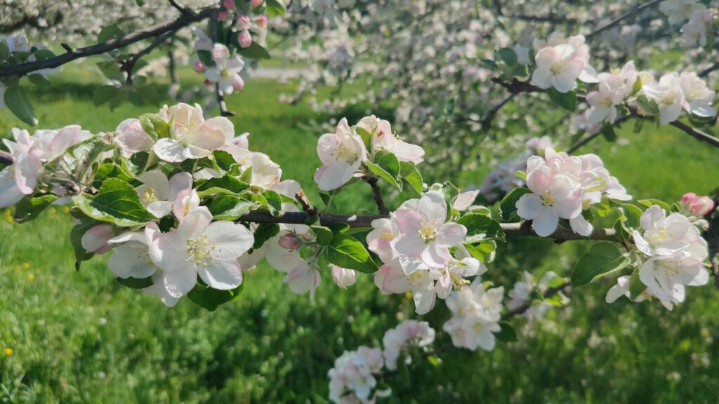
After Lauchringen and Tiengen, the route leads down to the Rhine. Once again, I enjoy the blossoms of the fruit trees.
Unfortunately, this is followed by a rather desolate shopping area. License plates from the canton of Aargau probably don’t make up the majority, but they are also not a minority. Everything that can be transported is being bought.
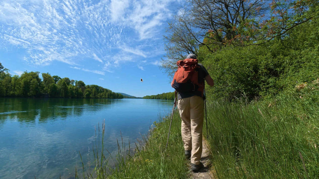
Only at the Rhine’s bank does tranquility return. On the left, the mouth of the Aare into the Rhine can be seen, or as Uli would later say, actually the Rhine flows into the Aare. Because the Aare is large and imposing, while the Rhine is rather pushed to the side from the left.
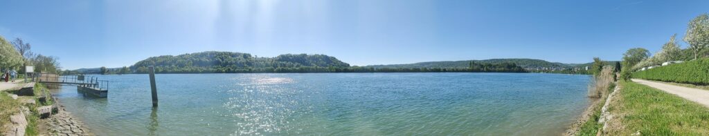
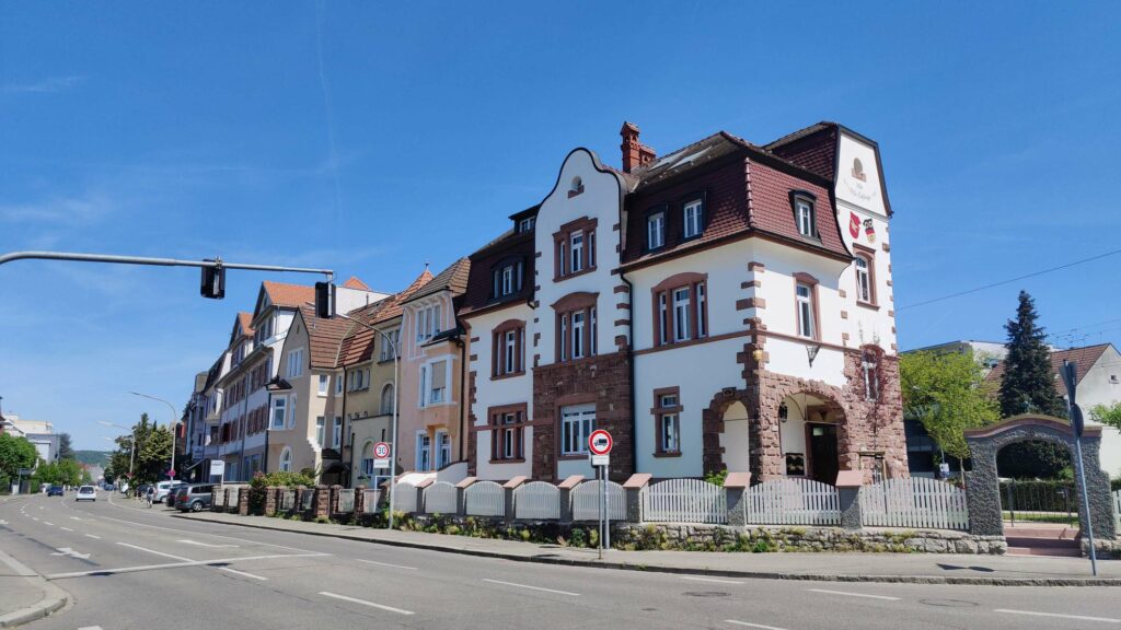
The remaining path to Waldshut is pleasant and short. A small, steep path leads up to the train station and the old town.
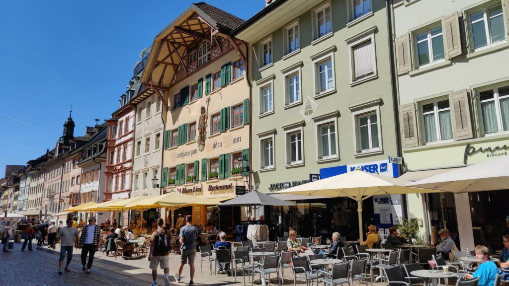
The small town of Waldshut offers a journey back to the Middle Ages. The best way to experience this is with a guided tour of the town. In the late afternoon, I meet Uli. He has been a tour guide in Waldshut for many years and accompanies me through the old town.
Of course, I’d like to ask Uli if there are any historical connections between Waldshut and Switzerland, and if so, what they are. Uli tells me the story of the Waldshut War. He says that at the end of the 15th century, 12,000 to 15,000 Swiss soldiers were stationed in front of the city, and the conquest would probably have been certain.
The Confederates had only wanted to return to their fields in late August, and therefore they agreed to the peace proposal of the Bishop of Basel. It stated: either the Habsburgs pay 10,000 gold guilders within one year, or Waldshut falls to the Confederation. The Swiss did not believe that the Habsburgs would be able to pay.
However, the Habsburgs borrowed the money from their Burgundian relatives,
using Waldshut as collateral. The Helvetians received the gold and Waldshut was under their control for several decades, after which they bought back the collateral. And that is how it came to be that neither Waldshut nor the Black Forest became part of the Swiss Confederation.
Uli tells me about his time as the head of the Waldshut police station. I ask him about the cooperation with Switzerland. He says he conducted his first house search in Switzerland, accompanied by a Swiss colleague. But that was a long time ago, before there were any agreements in place; those came much later. And whether it’s easier today is a different question.
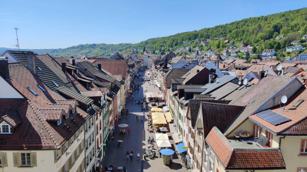
Uli takes me all the way up to the upper city gate, the Schaffhausen Tower. The view of the city and the surrounding area is breathtaking. The building was said to have been in a state of decay for a long time before it was renovated by the Narro-Zunft as a community service project.
The city saved on costs, and the Narro guild, in return, received historically significant premises. The Narro guild has existed since 1411, and thus originated decades before the Confederates intended to conquer Waldshut.
I could listen to Uli’s stories endlessly, but the evening is drawing near. Uli, I thank you from the bottom of my heart for this exciting and humorous journey into the history of Waldshut.
Day 6: Along the Rhine to the Waste Museum
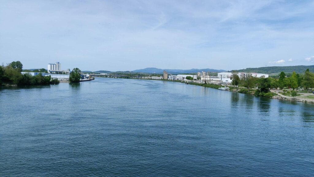
My path leads me along the Rhine towards Basel for most of the day. At some point, I see a sign that says ‘Basel, 59 km’. And I want to be there tomorrow. However, when you hike for a long time, the kilometers somehow seem to disappear along the way. The important thing is to complete the next step and enjoy the nature.
The Rhine’s banks offer a remarkably natural landscape. If it weren’t for the tower on the Swiss side, which is prominently reflected in the Rhine, the idyll would be perfect. The Leibstatt nuclear power plant is an unavoidable presence that accompanies you for a considerable time.
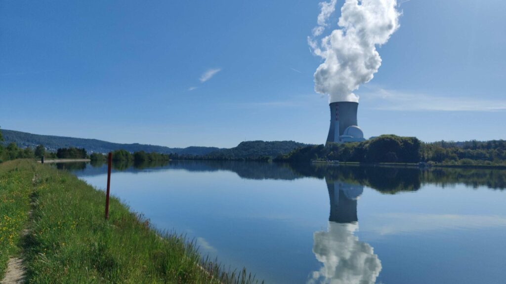
It’s almost surreal, but on this sunny morning, I suddenly notice shadows on the path. It’s, in a way, the shadow of the nuclear power plant. This spectacle doesn’t last long, but the tower and the cloud accompany me for several hours.
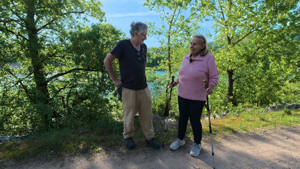
While walking, I come across a female hiker who glances at me and then says that I must be planning a longer hike. We strike up a conversation, and Mona tells me that she is now relearning how to hike after an operation. She says that she has enjoyed hiking her whole life.
In a spontaneous interview, Mona tells me about her professional activities, how she started publishing hiking and cycling guides about the Black Forest. Back then, there was no internet, only analog photography. It was tough at the beginning, but she was able to turn her hobby into a profession (see also her interesting website schwarzwald-erlebnisse.de).
As I continue walking, I reflect on our conversation, about the limits of aging, hiking, memories, and the longing for steps. Thank you, Mona. I’ve met quite a few people on my hike so far, but I haven’t met anyone who shares as much passion for hiking as you do.
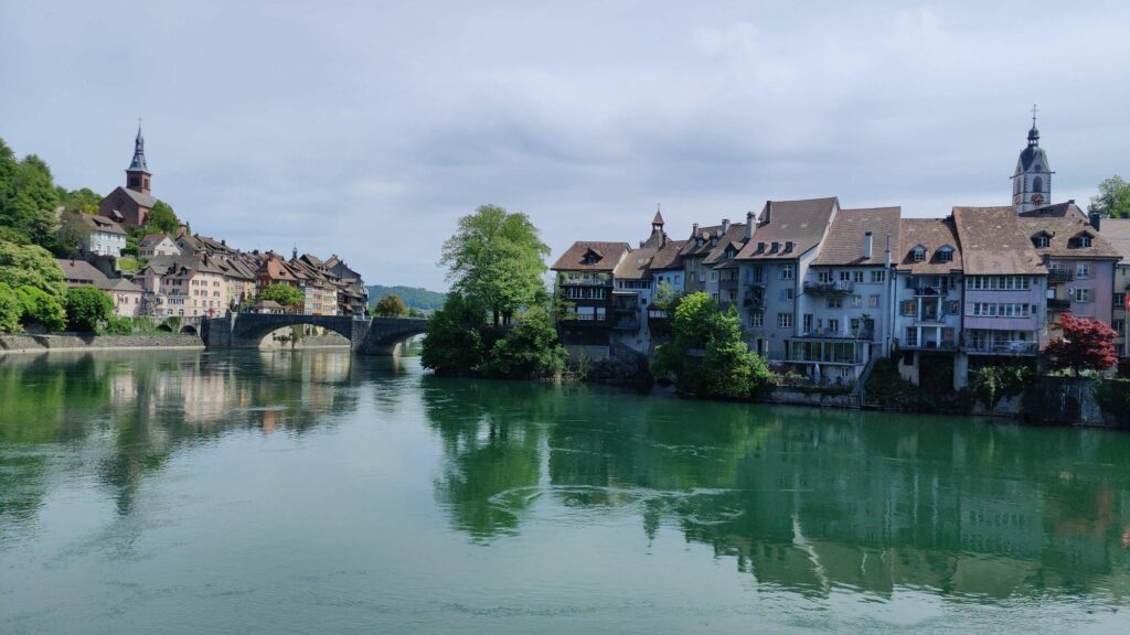
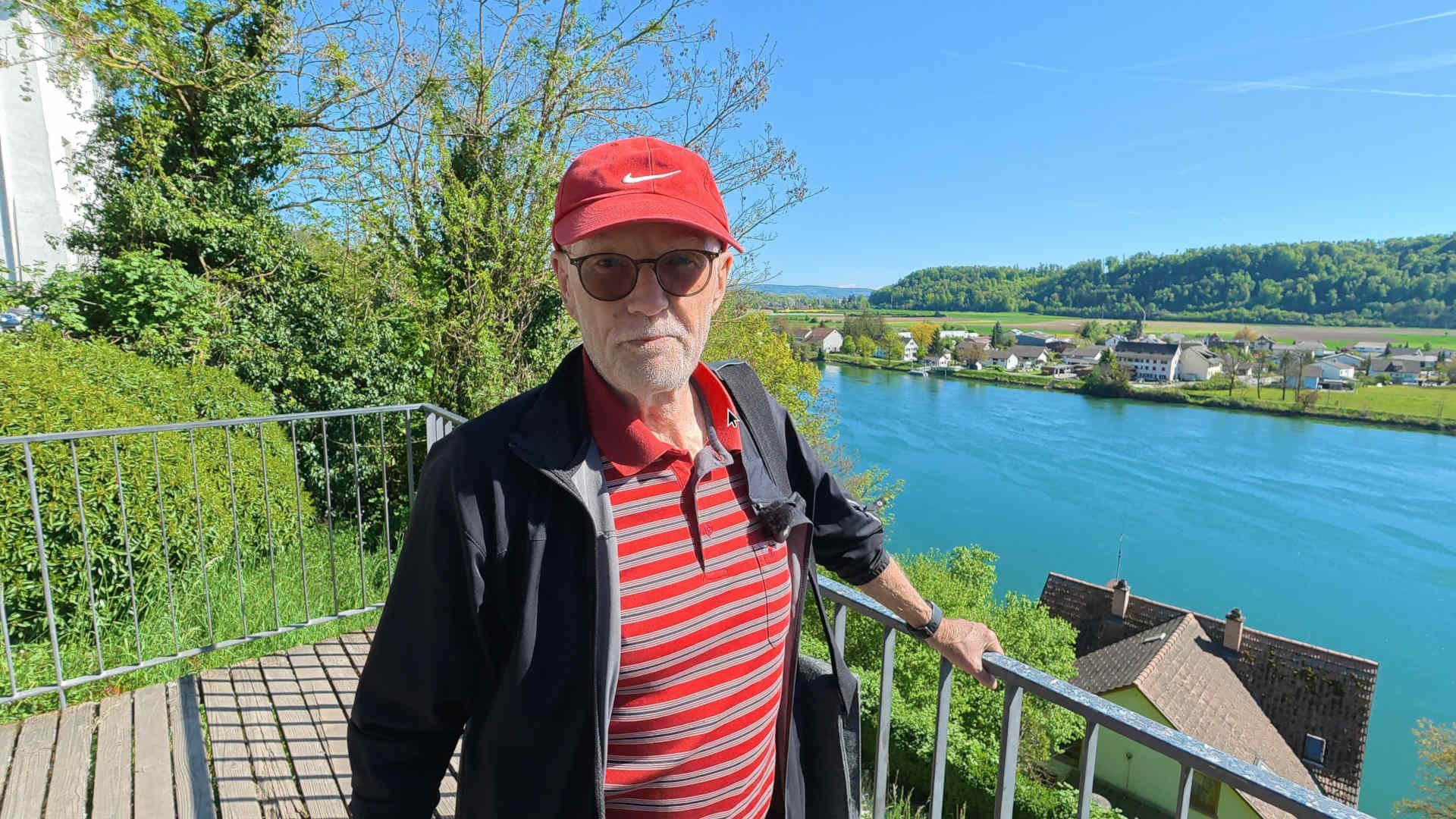
I will reach the small town of Laufenburg after lunch. Actually, there are two small towns. If you look downstream, Laufenburg CH is on the left, and Laufenburg D is on the right.
In this photo, I’m already looking back, with the German side on the left and Switzerland on the right. For me, even here, borders are being overcome, as both sides connect with each other in a symbiotic way through the bridge.
My journey continues to Bad Säckingen and then to the Trash Museum in Wallbach. Unfortunately, I didn’t have enough time to spend in Bad Säckingen, even though the old town with the longest wooden bridge in Europe was certainly an attraction.
Because of meeting Mona, I’m running late. To be at the Garbage Museum by five o’clock, I need to hurry. Easier said than done. The heat is intense, and my feet hurt. Luckily, I can “recharge” my fuel at a gas station, because even walking, I can’t get there without some “juice.”
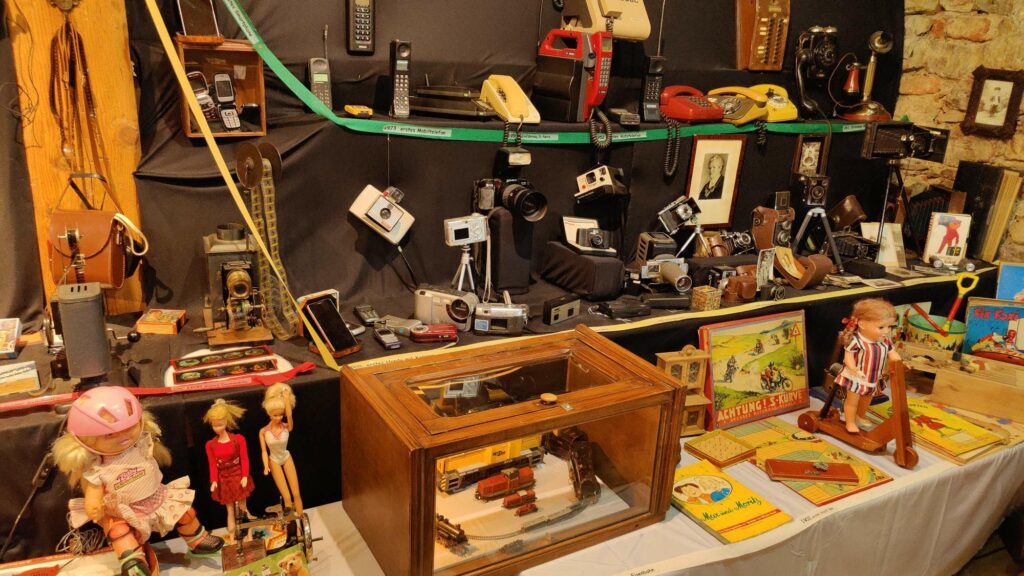
The Trash Museum in Wallbach came about because Erich Thomann, several decades ago, fell in love with a teddy bear he saw staring at him from the landfill.
He simply had to take it home, his wife restored it, and since then, objects have accumulated around it, one after another. Things that ended up in the trash, but could actually still be used.
Erich Thomann passed away in 2021 at the age of 90. His son, Karl, is responsible for ensuring the museum continues to exist. I ask Karl what it was like to be the child of “garbage collectors.”
He tells me that it was perfectly normal, that his father used to bring things home all the time. That’s how the museum came about in 1991. Even today, only a small part of the collection can be displayed.
Ultimately, the Museum of Trash allows visitors to marvel at what has been thrown away, but is also a testament to bygone eras. He was particularly pleased by the encounters with those who had found their belongings again in the Museum of Trash. This reunion was quite emotional. Dear Karl, all the best and indescribable thanks for this journey into old treasures.
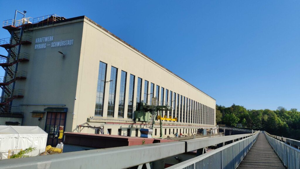
I have the last five kilometers to go to Schwörstadt. Unfortunately, I can only see the last bus at the bus stop from behind. On Sundays, there are no more buses after 5:50 PM. So, what to do? There are no more buses in the neighboring town either. I remember that a few kilometers further down, near the Ryburg-Schwörstadt power plant, it is possible to walk across the border to Möhlin.
Out of the 34 kilometers, it becomes 39 before I cross into Swiss territory. It would be another five kilometers on foot to the train station in Möhlin. That’s too much effort, so I order a taxi. That already saves half of the evening.
Day 7: From Germany to France
The extra few kilometers from yesterday have left their mark, and not just on my feet. Even the taxi driver now wants to know exactly what on earth motivates me to travel from the Rhine embankment to Möhlin train station and back the next morning.
He drops me off at the Rhine Riverbank, looking both surprised and disbelieving. I think he’d rather drive a taxi, and perhaps I’ll enjoy hiking more than I would riding in the car.
I’m heading back across the border, and soon I’ll be leaving the Rhine behind. If I were to walk along it, I would inevitably end up back in Switzerland, passing through Basel. But I don’t want that, so I’m heading over gentle hills towards the foothills of the Black Forest.
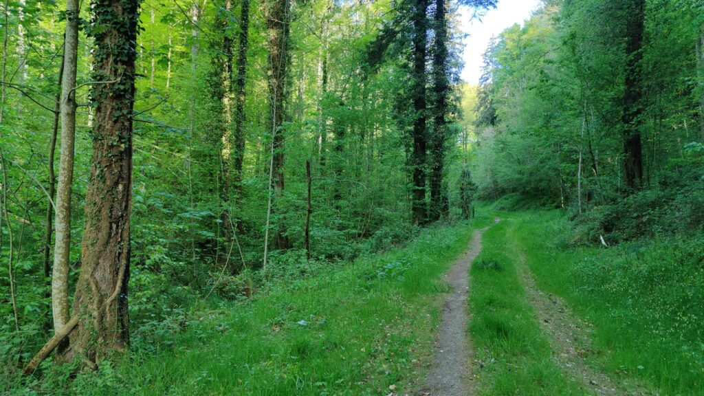
These are lovely forest paths. You walk alone through the hilly landscape. There are a few villages, but mostly it’s nature. The border to France is still 20 kilometers away, Basel is the same distance. Nothing here reminds you of urban civilization.
After about 15 kilometers, I pass a highway. Civilization is getting closer, with a brief, first impressive view of the Vosges mountains, followed by Lörrach. The main road is torn up, with construction machinery everywhere. In an Asian restaurant, the guests are discussing the roadworks. No one knows how long they will last.
Lörrach doesn’t really have a big-city feel. I hike over a hill. Once again, my path leads me to the peculiar border of Switzerland. Vineyards to the left, vineyards to the right, vineyards below and above, and eventually a border stone greets me.
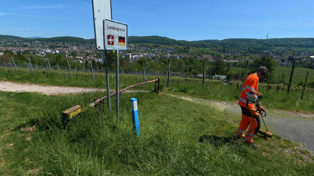
If there weren’t a sign indicating the border, no one would even notice it. Okay, the loud “roaring” of the lawnmower suggests that the grass is probably mowed more often on the Swiss side.
The peculiarity of the scene is enhanced by a lavishly decorated, low-lying barrier, emphasizing that the field path is only paved on the Swiss side. According to the flags, it looks the other way around, but (even more curiously), the coats of arms are reversed. Switzerland should be on the right, Germany on the left.
On the further way down to the Rhine, the route leads through Weil am Rhein. Initially, there are mostly single-family homes, but later the buildings become taller. It only becomes truly urban in the last kilometer.
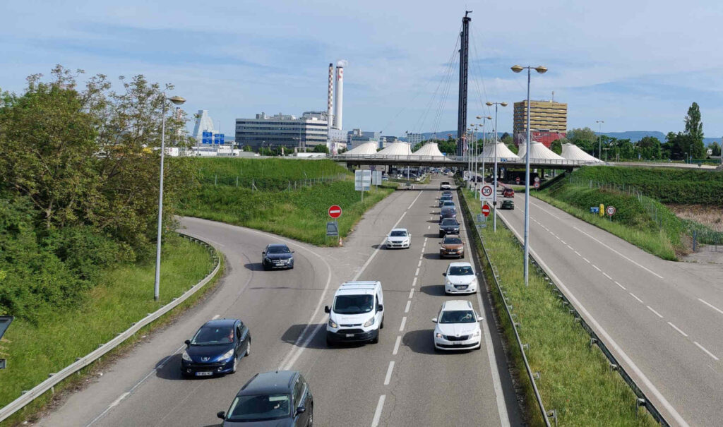
The border crossing into France is via a spacious pedestrian bridge that was opened in 2007. The view of the Rhine and Basel is magnificent.
There isn’t a border in the strict sense. However, if you listen carefully, you’ll already hear French being spoken as you cross the bridge. Germany is now behind you. I look back on the first 225 kilometers with a lot of nostalgia. It was nice being in Germany, no doubt about it.
I had imagined the transition into France to be much more exhilarating. Yes, the Rhine is beautiful, and so is the bridge. The vastness here is also great. But primarily, it was just hot, and my feet were aching. And there are still over 1000 kilometers to go.
My pace is leisurely, yet it doesn’t take long before I finally arrive in France. ‘La Grande Nation’ greets me in Huningue, almost in a monumental way.
After that, I pass through a few kilometers of suburban areas, which I navigate wearily. The early evening traffic forces me onto the sidewalks, if there are any. Along the road, there are often shops; Piscine68, open 24/24, is one that I remember.
The range of bathtubs and accessories is enormous. The only thing missing is the opportunity to test them out. And so I continue on my way, looking forward to seeing the church tower of Hésingue.
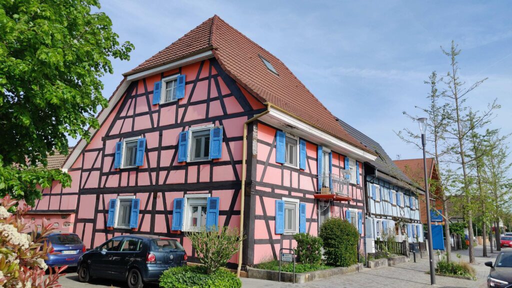
When I finally arrive at the church and see the first Alsatian houses, like something out of a museum, I make peace with the asphalt of France. Tired, I board the bus.
Around 5:26 PM, I’m the only passenger on the bus heading to Switzerland. Presumably, everyone will be returning to France in the evening. The two half-cantons of Basel record approximately 60,000 commuters. Of course, I’m grateful for the good bus connections, but somehow the empty bus also highlights how one-sided the whole situation is.
The “private bus” to France early in the morning, which will take me further along my hiking route, is definitely guaranteed. But even more than a comfortable seat, I’m looking forward to finally being able to leave the Basel border region behind.
Shortly before Hésingue, a man asked me if I was hiking the Tour de France. No, I was going to hike around Switzerland. He walked on to his car, wished me a good hike, and drove away. This example clearly shows that the tri-border area in Basel is heavily dominated by motorized transport.